Coming to a commute near you: Melbourne launches world-first connected living transport lab
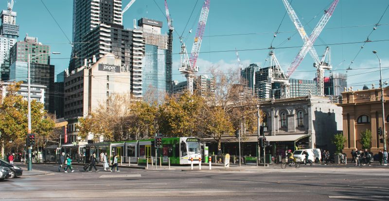
The fringe of Melbourne’s CBD will become a connected transport living lab from this year, in an ambitious project that will connect data from vehicles, bicycles, transport infrastructure and more, to prevent traffic jams and crashes and cut travel times and carbon emissions.
The project, led by the University of Melbourne School of Engineering, is now set to hit the streets following the signing of a Memorandum of Understanding with 17 private and public sector project partners.
The University is collaborating with industry leaders from Australia and around the globe to integrate data from VicRoads, Public Transport Victoria, the City of Melbourne and the City of Yarra with traffic updates from global giant HERE Maps, to deliver insights into traffic planning, pedestrian flows, public transport efficiency and freight movements.
A 1.2 square km ‘test bed’ taking in busy freight and commuter routes and shopping strips — including Australia’s most congested road, Hoddle Street — will be fitted with thousands of sensors, enabling communication between thousands of devices and data sets that have until now been islands — such as tram and train movements.
Melbourne School of Engineering Dean Iven Mareels said this would pave the way for connected and autonomous vehicles.
“The whole world is talking about driverless vehicles and climate change, energy conservation and reducing pollution,” Professor Mareels said.
“These are issues faced not just by Melbourne as it seeks to retain the quality of life that has made it the world’s most liveable city for many years, but by thousands of cities around the world that desperately need to accommodate expanding populations, economic activity and community expectations.”
Project lead Majid Sarvi, Professor in Transport for Smart Cities, said connecting smart sensors with smart devices opens up a whole world of connectivity.
“Intelligent transport systems will analyse this data and deliver insights into traffic planning, pedestrian flows, public transport efficiency and freight movements," he said.
“The research tells us that connected transport could in time reduce the economic impact of road crashes by 90 per cent, not to mention the devastating human impact.”
The test area includes 7km of roadways and is bounded by Alexandra Parade to the north, Victoria Street to the south, Hoddle Street to the East and Lygon Street to the west.
Professor Mareels said international industry leaders are attracted to this project because of its ambitious scope, significant scale and strong research base.
“Success will mean safer cities, cleaner cities, happier cities and more liveable cities,” he said.
“The Victorian government’s commitment to open data and leveraging this to benefit the community ensures the central role of VicRoads and Public Transport Victoria in bring about tangible improvements to the quality of life in Melbourne for many decades to come."
The University’s project partners are: VicRoads, Public Transport Victoria (PTV), Department of Economic Development, Jobs, Transport and Resources, the City of Melbourne, the City of Yarra, ITS Australia, CUBIC, PTV-AG, HERE Maps, Siemens, Ericsson, Telstra, nbn, WSP Parsons Brinckerhoff, HMI Technologies, Transdev Melbourne, ConnectEast and Mobility as a Service Australia.